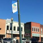
Summer is here. It’s going to be getting hot. Since June is Dairy Month, grab a dairy treat and get ready to take a road trip! Begin your tour on the Square in historic downtown Newberry.
From the Square, turn left on Nance Street. Newberrians have always found ways of cooling off. One historic way was to visit Vanduslah Spring, the site of an eighteenth century tavern and a popular watering hole for lawyers in town for court. Though neither the springs nor the tavern is still around, they were presumably in this immediate area. Turn left on Boundary Street. On the right, at the corner of Caldwell Street, is First Baptist Church. Founded in 1831, this is the oldest congregation in town. The second oldest is Central Methodist which can be seen to the left. By the way, the oldest Lutheran congregation is Redeemer. Founded as Luther Chapel in 1853 near Vanduslah Spring, it became Redeemer when it moved to the corner of Wilson Street in 1897. Turn left on Calhoun Street and right on Main Street. Stay on Main Street as it becomes Hwy 219. While driving through the county, watch out for the blooms of Mimosa, Queen Anne’s Lace, Black-eyed Susan and ubiquitous orange daylilies.
Bear right on Hwy176 and continue down the road to Pomaria. Though the area along Crim’s Creek had been settled by the 1750’s, the town was not established until 1851 when the Columbia & Greenville Railroad came through. Turn left on Holloway Street. On the left is the 1895 House with its wraparound porches and fancy gingerbread. Turn left on Folk Street (which becomes Peak Road in a few blocks). On the right is Pomaria Lutheran Church which was founded in 1910. Its cemetery is ahead on the left. Along the right side of the road, vistas begin to open up toward Little Mountain. Turn left on Broad River Road.
Down the road is the Cannon’s Creek Fill. The “fills” were created when the Parr Shoals dam backed excess water into the mouths of two tributary creeks. They had to fill in the road to create causeways with bridges. While crossing the second fill at Heller’s Creek, look to the left to see the original causeway and some supports for the old bridge. The Parrot House, a mid-nineteenth century farmhouse is off the road to the left. At the corner of New Hope Road, the old building of Ruff’s Store is on the left. Down the road on the left is the Crooks House. Built in 1896, it has a wraparound porch with decorative brackets. The Suber-Dickert House is on the right behind some trees. Built by the Suber family in the 1850’s, it was later the home of Col. Augustus Dickert. Turn right on Hwy 34.
Cross the Aubrey Harley Bridge (named for a prominent Newberry attorney) into Fairfield County. Like Newberry, Fairfield was one of the counties created in 1785 when the old judicial districts were divided; however, Fairfield was part of the Camden District instead of Ninety Six like Newberry. Tradition has it that the name refers to a statement made by Gen. Cornwallis during the British occupation (1780-1) about “how fair these fields” were. Turn left on Old Blair Road. Down the road on the right is the Blair Quarry. Turn left on Granite Road. Turn around at the old R.M. Blair Store and continue straight back onto Old Blair Road. Turn left on Buckhead Road. On the right is a triangular-shaped park called Woodpecker Point. There are some nice vistas of rolling hills along this road. It doesn’t take much imagination to erase the forest and see farmland instead. At the crossroads, turn left on SR-99. On the left is Weeping Mary Baptist church, which was founded in 1903. The present church was built in 1972. A red mud-stained cemetery is next to the church.
Turn left (at the Recycling Sign) on SR-33. The road would lead to Shelton, but the town isn’t there anymore. Shelton is the point on the map where a ferry crossed the Broad River just south of the confluence of the Tyger River. (In Newberry County, Shelton Road veers off from Dogwalla Road.) The road ends at the railroad tracks. (These tracks, which you’ll see at various times on this trip, are part of the Norfolk-Southern Railroad. They follow the Broad River and intersect the old Columbia & Greenville line at Alston, across the river from Peak.) Turn around. On either side of the road are suggestions of a small town – a chimney, a brick wall and some granite. Turn right on Clayton Depot Road. On the right is Silver Ridge Lodge (Order of the Eastern Star) with a small cemetery behind it. The road gets more and more desolate. As it begins to bend to the left, on the left, you can see six granite towers, which were cisterns for the Shivar Springs Bottling Co. Founded as Clayton Bottling in the late-nineteenth century, Shivar Springs originally bottled mineral water. By the 1920’s they had branched out to ginger ale and soft drinks. The company went out of business around 1950. Keep following the road. It becomes a dirt lane but loops back into itself. At the end of the road, turn right on SR-33. Turn left on SR-99 and keep going. At one point there will be a sharp left-hand bend around a late-nineteenth century farmhouse. At the end of the road, turn left on Hwy 215. On the left is an old farmhouse with end chimneys, reminiscent of similar homes in Newberry County.
Cross into Chester County. Also created from the Camden District in 1785, Chester is named for Chester County in Pennsylvania, near the other end of the Carolina Road. Cross Sandy River as it meanders along its way to meet the Broad. Turn left on Hwy 72-121. Cross the Broad River at Fishdam Ford into Union County. Though the fish dam (or wier) is not very visible in the swollen river, it is a series of v-shaped rock dams that the Native Americans used to herd and catch fish. It is also the site of a Revolutionary War Battle which took place in the middle of the night on November 9, 1780. Gen. Thomas Sumter’s camp was surprised by and repelled an attack by the British. Like Newberry, Union was subdivided from the Ninety Six District in 1785. Turn left on the first paved road (Edwards Road). Cross the railroad tracks and turn left. Down the road on the right is Kelly’s Chapel Cemetery. This road is roughly following the afore-mentioned railroad. Turn right on St. Luke Road. On the left are St. Luke AME Zion Church and its cemetery. The church has two square towers flanking the doors. Continue on St. Luke Road. At the stop sign, turn left. Cross the Tyger River into Newberry County. On the left, an old metal trestle can be seen. Now that we’re back in the center of the universe, this is Tyger River Road. Turn right on Peter’s Creek Road (the first road on the right) to pass by the Hardy House, built circa 1825. Cross back into Union County (for a moment). At the end of the road, turn left. Return to Newberry County.
Turn right on Brazelman’s Bridge Road (the first paved road). On the left is the site of Ebenezer Methodist Church which was founded in 1784, the first year of organized Methodism in America. The cemetery is next to the site of the old church. After the old church burned, the congregation merged with Whitmire United Methodist Church in 1974. Down the road on the left is Seekwell Baptist Church. Founded in 1867, it is one of the oldest African-American churches in the county. Cross the Enoree River. Another metal trestle can be seen here to the right. Continue down the road until you cross Hwy 176. On the left is Long Lane Acres, a typical early-nineteenth century farmhouse. Turn left on Hwy 121. Follow it as it becomes College Street and return to historic downtown Newberry.

