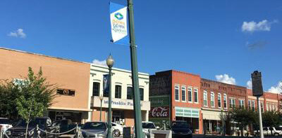
Over the past several years, July has been a time to follow one of the waterways in and out of the county to find its source. We have one river left in the set – Little River. Like Bush River, Little River begins in Laurens County and ends in the Saluda River. Also, like Bush River, it’s more like a creek than a river, but when there are heavy rains involved, both can be ferocious. Grab some cold beverages and begin your tour on the Square in historic downtown Newberry.
Head east on Main Street and turn left on Drayton Street. Turn right on O’Neal Street. As you leave West End (the mill village for Newberry Cotton Mills) cross Scott’s Creek. Off to the far right up the creek is Willowbrook Park. Turn left on Hwy 121 (Kendall Road). Turn right on Hwy 34-121. Stay on Hwy 121 when Hwy 34 veers off. As we head out to the edge of the county, we will first cross Bush River and, a few miles later, Beaverdam Creek. Bothe are heading downstream to the Saluda River. The heat of July has begun to strip the flowers from the landscape, but the bright orange of Cow-Itch is visible along pasture fences. In yards, new and old, the colors of Crape Myrtles are approaching their peak of vibrancy. Soon after you pass Deadfall Crossroads, turn left on Higgin’s Ferry Road. Pull into the parking area for the boat ramp and get out to have a look at the Saluda River. Less than a mile upstream, the Little River joins the flow of the Saluda River, having drained much of southwestern Newberry County. Return to Deadfall Road and turn left.
Turn left on Werts Road. Cross the railroad tracks. The tracks are coming from Silverstreet and heading toward Old Town, the site of the next to the last depot along the tracks of the Columbia & Greenville Railroad before it crosses the Saluda River. Cross Turner’s Creek. Near here is the site of Turner’s Blockhouse. William Turner fortified his home with a palisade to defend his family and neighbors from a Cherokee attack in 1762. Turn left on Hwy 34 and cross Little River.
Turn right on Champion Nursery Road. Turn right on J C Floyd Sr. Road. As you make the turn, a vista opens to a hazy sky above dark pines. This is the valley of Little River. Take this old dirt road slowly – it’s the sort of road for which these trips were made. Turn right on Island Ford Road. Cross Mudlick Creek. About five miles upstream from here, on March 2, 1781, a small Revolutionary battle took place at Williams’ Fort. The Battle of Mudlick Creek was considered a Patriot victory, just barely. Turn left on Mudlick Road. Cross Mudlick Creek. By the way, a “lick” is a swift moving stream, so our creek has a bit of redundancy to it. Turn right on Hwy 56. Cross Mudlick Creek. Cross Little River. Down the road on the right is Davenport’s Store, a typical country store building. Along the left side of the road is part of the Belfast Wildlife Management Area, a facility of SC DNR covering 4,600 acres in Newberry and Laurens Counties. Bear left as Belfast Road merges into Hwy 56. On the left is Little River-Dominick Presbyterian Church. Little River, the county’s oldest Presbyterian church was founded in 1764. It merged with the nearby Dominick Church in 1938. Cross into Laurens County. One of the counties formed from the division of Ninety Six District in 1785, Laurens is named for Henry Laurens, a South Carolina leader in the American Revolution. On the left, almost straddling the county line is Belfast House. Built by Col. John Simpson, a native of Belfast, Ireland, the home was constructed in the early nineteenth century.
Turn left on Hwy 560. Cross Little River. Turn right on Mountville Road. On the left at the intersection of Jefferson Davis Road is the antebellum Young House. Jefferson Davis spent the night here on April 30, 1865, on his way to Abbeville. Turn right on Jefferson Davis Road. Cross Beaverdam Creek (not the same as the one in Newberry). Turn left on Lisbon Road (as you turn, you can see the Little River bridge down the hill). (I searched everywhere for some sign of Portugal or why it was called “Lisbon.” After the trip, I found a church with the name and a small community further up the road.) Turn right on Hwy 72. Cross Little River. Turn left on Milam Road.
You’ll see the sign, but watch out for the one lane bridge over the railroad. Down the road on the right is New China Baptist Church. (Later in the trip we’ll pass by New Grove Church. It makes you wonder if Old China Grove was between the two of them.) Turn left on Holmes Bridge Road. Cross Little River. It’s looking less like a river with each crossing. Turn right on South Harper Street Ext (SR 42). Cross Burnt Mill Creek. Turn right on Brown Road. Off the road to the left is a large antebellum home, with massive square piers. Cross Little River. Turn left on East Jerry Road. Cross another small tributary of Little River. Turn left on Hwy 127. Cross Little River. Stay in the lane that says “right lane ends” and turn right on S Harper Street Ext (SR 42). Turn right on Hwy 221 and almost immediately right again on E Farley Avenue. Cross Little River.
Turn left on E Main Street. On the right is the octagonal Zelotes Holmes House. It was built in 1858. Cross Little River. Turn right into Little River Park. Stop for a moment to get up close and personal with the stream of the river we’ve been following today. There’s a walking trail, restrooms, a picnic area and a putt-putt course. The trail goes under the old railroad trestle and also under bridge of the next street. It even leads up the hill to the old cemetery. While in downtown Laurens, be sure to see the courthouse in the middle of the old Square. Begun in 1837, the courthouse was enlarged in 1857. The old part of town is built on two hills with Little River running between them. Local tradition has it that the town founders were drunk when they decided on the location for the courthouse and Square. This may be a nod to one of the earliest industries in Laurens – the distilling of whiskey. Drive along Main Street to see the old churches. The Episcopal Church of the Epiphany was built in 1845. First Baptist, First Methodist and First Presbyterian appear in succession down Main Street. Like Newberry, Laurens also has many large homes stretched along Main Street. Be sure to see the homes along S Harper Street as well. When you finish visiting the town, head north on N Harper Street (Hwy 221).
Cross Little River and Hwy 76. (Off to the right you can see the end of the park.) This end of Laurens is known as Wattsville. Turn left on Ranch Road. Cross Little River. Turn right on Lakeview Drive. Cross another unnamed tributary of Little River. Turn right on Owens Drive. Turn right on Bramlett Road. This is a narrow lane. Cross Little River one last time. I had a hard time spotting the creek among the marshy grasses, but there is a little bridge. Turn left on Metric Road. When you get to Hwy 14, turn left. On the map, this is called Barksdale. Somewhere off to the left, Little River has its beginnings in a pond and a small stream.
There are several ways to get back to Newberry from this end of the trip. Continuing ahead, you’ll reach Hwy 76, which of course leads back to Newberry by way of Clinton, Joanna, Kinards and Jalapa. You’re also pretty close to I-385 which leads to I-26 and points east. If you’re adventurous, you can follow the trip backwards and see things from a different perspective, or even try other roads. In the end, be sure to return to historic downtown Newberry.


